An Overview of New and Small Starts
Currently $1.5 Billion Largest Discressionary Grant Program in the United States
Total cost of the pipeline is $26 Billion
$10 billion in New and Small Starts
Cost Effectiveness - Some metric to look at these projects was sought
Economic Development - More Recent Criteria: Economic Development
Program Goal:
Fund Meritorious Projects
-Develop reliable information on project benefits and costs
-Ensure projects are treated equitably
-Facilitate Communication between FTA, transit industry and congress
Project Development Process
Typically 6-12 years
AA- 1-2 Years
PE - 2-3 Years
FD-Construct - 3-7 Years
Systems Planning: Priority Corridor
Alternatives Analysis ie MIS: Decide mode and alignment
Preliminary Engineering: Final Scope/Cost
Final Design: Construction Documents
Full Funding Grant Agreements
Question: Where does the cost effectiveness measure come in?
Answer: FTA Decision on the entrance into PE
Alternatives Analysis
"We don't get involved in local process or local decisions"
Development of alternatives that isolate the costs and benefits of capital investment in guideways
Key Elements:
Identification of corridor problems, project "purpose and need" and goals and objectives
Preliminary Engineering
Work necessary to develope a firm scope and cost estimate with appropriate contingencies
Finalize station locations and configurations
Yard and Shop location
alignment
park and ride size and configuration
Number of vehicles and peak capacity needs
Complete enviro requirements
Work to firm up funding commitments
Subject to congressional appropriations
Caps on Federal Section 5309 New Starts Funds
85% of New Starts gets appropriated for FFGAs
All projects eventually receive 100% of their money
Practical limits on Total New Starts funding and annual schedule
No more than $750 million in total project funding
Evaluation and Oversight
-Most Rigorous Processes in Government
-Increasingly credible and important to Congress and local communities
-Program Management Oversight recommended by GAO and OIG
Mobility improvements
Environmental Benefits
-Our projects are a drop in the bucket, they aren't really able to be used in the construct
-Operating Efficiencies
-Cost Effectiveness
etc
Need a medium overall rating
Cost Effectiveness
Used instead of cost/benefit de to the difficulties in monetizing all transit benefits
Effectiveness measure represents either most of the benefits of projects or is highly correlated to other benefits
Costs- Annualized incremental capital (federal and local) plus incremental annual operating cost vs no build project
Effectiveness addresses the transportation benefit of the project -annual travel time savings for users of the project.
Source of Transportation Benefits of New Starts Projects
Highway Users
Current Transit Users
New Transit Users
No highway but rather transit user 'benefits'
In Vehicle Time
Walk and wait time
number of transfers
capacity constraints
reliability, comfort, security, branding
Utility Measures?
Cost Effectiveness Rating
Land Use Rating Criteria
Not as quantitative as the Cost Effectiveness rating
Small Starts
$250 Million
New Starts Share = $75 Million
The intent of the legislation was the identify premium bus projects??? BRT.
Worried about projects that were really small. Created the Very Small Starts program
Planned outreach activities.
APTA Local meeting
Travel Forcasting
Alternative Analysis Course in San Francisco
Tuesday, August 28, 2007
Final Review of Workshops
Challenges of Bus TOD
The perception of the bus: buses are percieved as social service while rail is for everyone. A challenge for buses to overcome it. In a lot of places, there won't be rail or BRT
The fixed nature of bus routes versus rail
Do a better job with bus stops, have amenities, make them more of a place. The cost of constructing nice bus stops and maintaining them is a challenge
Transit at the table: A lot of transit agencies do not know what to do once they are at the table. Where do you go from there? What to ask for and how do you deal with it? Pace offered to do free reviews for developers. Collegial discussion on transit.
Design guidelines. Pace and AC Transit have design guideline manuals. In discussions for this, you need to look at the ped experience of the major development.
You really do need a champion
The challenge of greenfield development. How do you make sure the streets can handle transit options
How do you figure out how to pay for transit. Fee paid for by the residents of the future developments.
Patience, Persistence
Thinking Beyond the Station
Three Broad Things - 7 Points Listed in the Post Below.
Improvements Needed In Analytical Tools
Modelers tend to be in the position of providing one specific number:
How can something else be done?
Reliability - Giving people an idea of how good the number is
Probabilities - A range of numbers with the notion of the range will be the most probably outcome
What kind of people are there or will be in TODs. How do we get information about these people. Self selection. How willing some people are to do things like walk when they live near transit?
What characteristics are there about people who decide to live near transit. Captives vs. Choice? It's an illustritive example. Are the low income without cars by default or high income without car by choice?
Land use planning and transit planning together. Look at how decisions affect outcomes
--
Pricing
Liability of the transportation system
Average User knowledge of the system
The Traffic Issue of TOD : focusing on both sides of the issue
How much development can we expect in TOD anyways?
Afternoon Workshops
There are three afternoon workshops. If anyone wants to add notes from them please feel free to post in the comments.
Right now i'm sitting in the Thinking Beyond the Station Workshop. I'll post some of the notes from the white board when I get a copy.
About CSS
What did we learn?
Finding Money, Financing Problem
Transit is the first priority, related facilities are next
Customer Service Aspect of Transit - Serving the riders as a customer
Creating a sense of place with transit facilities, no one size fits all
Communicating Differences
Education
Visionary Leadership and Ongoing commitment
Making decisions along the corridor, making decisions at different places
#1 Improved Planning and Analysis Methods for Transit Regions
#2 Thinking Beyond the Station
#3 Improved Coordination of Transit and Land Use in Bus Only Locations
Focus on the Neighborhood
Neighborhood Focus: TOD, Transit-Sensitive Development and Development-Oriented Transit
Moderator, Todd Hemingson Capital Metro, Austin Texas
Cynthia Nikitin
Transit Supportive Spaces and Features (Place-Defining, Transit Ridership-Building TOD Projects)
Transit should see itself as a community shaper instead of just a transit agency.
"We shape our buildings and thereafter our buildings shape us. - Winston Churchill
"We shape our transportation systems and thereafter, our transportation shapes us. - Transportation and Livable Communities Consortium.
Redesigning the train station to look like a welcoming place instead of just a node along the way.
Communities after the riots in LA had no shelters. The Arts forum rented the spot for a dollar and advertised their art shows. The pizza place moved in and put in a garden and had a coffee bar. One bus stop. Partnerships created to leverage the value of transit.
Process/Discipline Driven Approach
Why is the community resistant? Because they are brought in so late in the process.
Create something where community leaders are experts through information
A tale of two libraries
The Riverside Library, the San Antonio Library
San Antonio Library, built for cars
Jane Jacobs: Erosion of cities by automobiles entails so familiar a series of events that these hardly need describing. The erosion proceeds as a kind of nibbling ... Because of vehicular congestion, a street is widened here, another is straightened there, a wide avenue is converted to one-way flow, staggered-signal systems are installed for faster movement, a bridge is double-decked ..., an expressway is cut through yonder, and finally whole webs of expressways. More and more land goes into parking, to accommodate the ever increasing numbers of vehicles while they are idle. ... "Cumulatively the effect is enormous. and each step ... is crucial in the sense that it not only adds its own bit to the total change, but actually accelerates the process.
Mockingbird Station, Englewood, Orenco, San Diego, Toronto, Mountain View ...
Benefits of a Placemaking Approach for community supportive transit.
Project for Public Spaces.
--------------------------------------------------------------
Sam Zimmerman Bergman - Reconnecting America
Housing Challenges and Policies to Support Transit - (Production of Mixed Income Housing around Transit: Local and State Policies that Work)
The national demand for transit will double by 2030. Types of folks will change
The Diversity and Demand Collision
The costs of transportation fluctuates
A Heavy Load : Report by CNT
Realizing the Potential: A study for the FTA and HUD
Lessons for Mixed-Income TOD
Not enough to just plan and zone for TOD to stimulate mixed income
Size of the parcels dictates a lot of the opportunities
Helps to look along a whole corridor
Not every station has to be mixed income
Discussion needs to happen early
Boston and Charlotte Tools see link above for Realizing the Potential
Seattle transit passes with new units
Targeting LIHTC for transit areas in some states
Community land trusts
Question: Seem to focusing on new projects, are you looking at projects that aren't new?
Answer: It's important to note that there is a lot of existing stock, some of which is expiring LIHTC.
Question: Can you explain Portland's development agreement?
Answer: There were certain targets set by the development agreement including density targets, affordable housing targets
------------------------------------------------------
Greg Kilcoyne
Reducing Parking Demand in Downtown (Influencing External Factors - Reducing Parking Demand)
APTA Transit Vision 2050.
Ridership: Internal and External Factors
If you aren't getting people in the seats, you're not doing anything to help the public
Downtown Bridgeport Revitalization
City wanted a vibrant transit friendly downtown
Numerous Surface Parking Lots Exist - Counter to Ambiance desired
Parking Lots provide development opportunities
Perception of Inadequate Parking - Will get worse with more development
The Parking Quandry
We don't want these lots, but there isn't enough parking
GBTA Conducted workshop : worked with developers
Focus on reducing demand for parking workers and residents
- Universal Passes
- Car Sharing Flex Car, Zip Car, City Car Share
Can reduce parking demand up to 40% with eco passes
Car sharing can reduce cars by 12 with each car they provide
Outcomes:
Downtown Study Recommendations
Urban Green Builders Plans
University of Bridgeport Plans
Seek out parking opportunities, influence external factors
Question: Should transit agencies separate themselves to make parking a money generating entity?
Answer: Charging doesn't seem to be a deterrent. There should never be a downtown surface parking lot.
Question: In Tulsa, there are no parking requirements. Did you bring in the financial community to your workshop?
Answer: We did not, however urban green builders was able to overcome the specific bank issue because when they were seeking financing they were able to get financing because they have the transit options. The developers aren't usually the obstacle, its usually the city and financial institutions
Question: Does transit need mixed income housing development or does mixed income housing development need transit?
Answer: A symbiotic relationship. There is a benefit to having a mixed income component because of ridership gains. The MTC in the Bay Area gives a 1.5 credit for their housing requirements for low and moderate income housing.
Monday, August 27, 2007


Coming to Grips with the Corridor
Corridor planning is in vogue. It's a scale that resonates because of its function in the transit planning process, it's more manageable than regional interjurisdictional land use planning processes, and it fits well with local land use regulations and overlays. But we are still coming to grips with what it means.
Dena identified corridor types from a transit and TOD perspective, thinking about regional connectivity and its impact on the development market. Jeff presented an initial look at what the impact of different transit modes on property values might be, and Bruce talked about what it takes to revitalize strip development.
The common theme that ran through all three presentations was that the answer is still not quite within our grasp. We can't quite isolate the real estate impact, perhaps in part because those decisions are made in response to so many other inputs beyond solely transit. We don't have a silver bullet for revitalizing the strip. It's a combination of design, density, diversity, distance, demographics, and perhaps even (d)history--sorry, couldn't turn that one into a 'd'.
So where are we? The corridor remains a very fruitful scale for long-range planning decision-making and policy-making. Getting things right takes a lot of effort, since solutions need to be tailored to local contexts, but, in the end, this is the scale of transportation and land use coordination where we need to get things right so that we don't waste all of our energy in hand-wringing over every individual site. What I'm not sure about is how the feedback loop works in linking the corridors back up to the region.
The Posters We Like the Mosters
TRB in the Rockies IV
Dots and Dashes
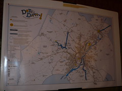
DVRPC 7th Largest MPO in the Nation PTP Pilot Program
Set up 20 Billion dollar spending limit
How do they split their spending on the existing system, versus network expansion.
Sketching out what people want.
Preliminary Results:
Working outreach tool
Data results from two sessions have been entered into a database
Composite results (Projects people most likely prefer)
A central public game session is pending.
-----------------------------------------------
Washington State's Growth and Transportation Efficiency Centers: Keith Cotton
Growth Management Act in 1990
Commute Trip Reduction
CTR Efficiency Act 2006
CTR only addresses large employers (Employers are required to create opportunities to not drive alone)
The GTEC program...
Bringing transit to the land use table
Directs RTPOs to coordinate
Increases efficiency on the state highway system in key areas
Requires that GTECs be prioritized
-----------------------------------------------------
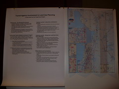
Transit Agency Involvement in Land Use Planning
Case Study from the Puget Sound Region
Snohomish County
Land Use Outreach
Lessons Learned
Obtained transit board endorsement of policies
New staff position dedicated to land use outreach
Approached problem from both ends
Leveraged Opportunities Created by the GMA
Emphasized coordination with local jurisdictions
No budget for facilities improvements
Connection with TDM program was informal
Outreach to the private sector was weak
Follow up with local jurisdiction infrequent
Didn't develop a robust tracking system to document program effectiveness
--------------------------------------------------
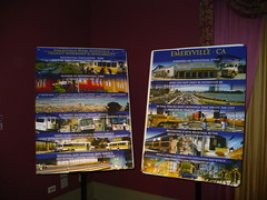
Where's Emeryville?
Nathan Landau of AC Transit. A dense city is basically a downtown. It doesn't have a BART station but does have Amtrak, bus connections. Emery Go Round
How does it become pedestrian friendly.
Service has been added.
Challenges
TAD vs TOD
Access cost equity
Erratic congestion
Limited potential for street/sidewalk
A new general plan
----------------------------------------------
Metrolink/Olsen Homes Partnership
Colleen Richter - Division of Marketing & Sales
JPA, made up of 5 transportation agencies
Fullerton station picture
Chasing developers for about 6 years. Olsen company is a smaller development company, intown living. Smaller urban development, live work medium to high residential density.
Objectives
Increase Core Ridership
Populate TOD
Leverage OPM
Attract Diverse Demographics
Influence Lifestyle Choices
Raise General Awareness
30% ridership is transient, changing work or jobs.
Very targeted marking but not necessarily to the general market.
The message: Life Without Traffic
Three Commuter Targets
At Work
In Traffic
On the Train
Between a 4 and 5000 dollar value for two years of metrolink service that the developer pays for.
$3.5 million in home sales. $50,000 dollars in free passes
------------------------------------------
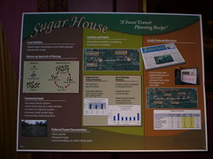
Sugarhouse Trolley
Very dense area
UTA owns the ROW
Transit and Land Use are Integrated
Unanimous Consensus to build a streetcar
------------------------------------------
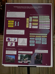
TCRP Research Urban Design and Mode Choice
What others think about where i live is as important as where I think.
Factors on mode choice
Compact Neighborhood
Values incorporated personal attitudes
Auto ownership, auto dependence, love of autos
----------------------------------------------
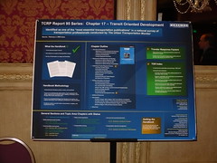
TCRP Report 95: Jay Evans, Dick Pratt
Several Factors
Land use site design
auto ownership
parking supply
parking pricing
transit support
Self selection
Dots and Dashes
DVRPC 7th Largest MPO in the Nation PTP Pilot Program
Set up 20 Billion dollar spending limit
How do they split their spending on the existing system, versus network expansion.
Sketching out what people want.
Preliminary Results:
Working outreach tool
Data results from two sessions have been entered into a database
Composite results (Projects people most likely prefer)
A central public game session is pending.
-----------------------------------------------
Washington State's Growth and Transportation Efficiency Centers: Keith Cotton
Growth Management Act in 1990
Commute Trip Reduction
CTR Efficiency Act 2006
CTR only addresses large employers (Employers are required to create opportunities to not drive alone)
The GTEC program...
Bringing transit to the land use table
Directs RTPOs to coordinate
Increases efficiency on the state highway system in key areas
Requires that GTECs be prioritized
-----------------------------------------------------
Transit Agency Involvement in Land Use Planning
Case Study from the Puget Sound Region
Snohomish County
Land Use Outreach
Lessons Learned
Obtained transit board endorsement of policies
New staff position dedicated to land use outreach
Approached problem from both ends
Leveraged Opportunities Created by the GMA
Emphasized coordination with local jurisdictions
No budget for facilities improvements
Connection with TDM program was informal
Outreach to the private sector was weak
Follow up with local jurisdiction infrequent
Didn't develop a robust tracking system to document program effectiveness
--------------------------------------------------
Where's Emeryville?
Nathan Landau of AC Transit. A dense city is basically a downtown. It doesn't have a BART station but does have Amtrak, bus connections. Emery Go Round
How does it become pedestrian friendly.
Service has been added.
Challenges
TAD vs TOD
Access cost equity
Erratic congestion
Limited potential for street/sidewalk
A new general plan
----------------------------------------------
Metrolink/Olsen Homes Partnership
Colleen Richter - Division of Marketing & Sales
JPA, made up of 5 transportation agencies
Fullerton station picture
Chasing developers for about 6 years. Olsen company is a smaller development company, intown living. Smaller urban development, live work medium to high residential density.
Objectives
Increase Core Ridership
Populate TOD
Leverage OPM
Attract Diverse Demographics
Influence Lifestyle Choices
Raise General Awareness
30% ridership is transient, changing work or jobs.
Very targeted marking but not necessarily to the general market.
The message: Life Without Traffic
Three Commuter Targets
At Work
In Traffic
On the Train
Between a 4 and 5000 dollar value for two years of metrolink service that the developer pays for.
$3.5 million in home sales. $50,000 dollars in free passes
------------------------------------------
Sugarhouse Trolley
Very dense area
UTA owns the ROW
Transit and Land Use are Integrated
Unanimous Consensus to build a streetcar
------------------------------------------
TCRP Research Urban Design and Mode Choice
What others think about where i live is as important as where I think.
Factors on mode choice
Compact Neighborhood
Values incorporated personal attitudes
Auto ownership, auto dependence, love of autos
----------------------------------------------
TCRP Report 95: Jay Evans, Dick Pratt
Several Factors
Land use site design
auto ownership
parking supply
parking pricing
transit support
Self selection
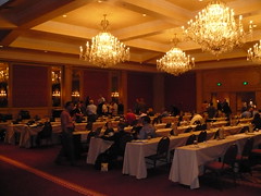
Transit Driving the Agenda
Apologies for the pun, but Cal Marsalla, RTD's General Manager and CEO, just gave a
lunchtime presentation on the portfolio of the system and how the agency has helped push the transit vision for the region forward. FasTracks has been so popular even while all of the lines still need to be delivered, that they are already looking at where to go next.
Too much to fully recap here, but what struck me was that RTD has been the very definition of proactive in looking to expand service, fill gaps, and innovate as they integrate transit throughout the region. From understanding effective messaging when formulating and campaigning for FasTracks to looking into pilot Design, Build, Operate, Maintain, and Finance* contracts on new corridors to pursuing a master development agreement at Union Station, there are lots of things going on in the Denver region that are not going on elsewhere in the country.
It all sounds so good it's almost too much to believe. Hopefully the inflation in construction costs won't derail FasTracks (again apologies for the pun, must have been something in the lunch) and RTD can continue their momentum.
(* apparently there is a lot of foreign interest in financing infrastructure investments in the United States and the length of financing can exceed the bonding capability of cities. Interesting to look into the broader implications of the this trend.)
All Along the Corridor, Hear You Sing Around the Station
Live Clog III: Return of the Clog
So here we are in the afternoon. We've got a fever, and the only prescription, is more TRB.
Dena Belzer
Transit Oriented Development, Potential and Outcomes | Presentation
Check out the Reconnecting America website for more information :)
What is TOD? A way to reduce auto dependence. Regional Connectivity, Financial Recapture and Low Cost Delivery of Riders.
Challenges of TOD
Tensions between place making and transit system needs
Transit alone does not drive local real estate investments
Planning for the TOD at different levels
The demand for housing or employment space is a top down endeavor at the regional level
Supply of TOD is local
System size matters.
Regions are networks of corridors: Planned and financed at the corridor levels. Real estate market can be accessed at the corridor level. Land use along a corridor.
Transit corridor types:
Commuter Corridor
District Circulator
Planned Growth Corridor
Destination Connection Corridor
The Hiawatha Light Rail Corridor: Opened April 2004
In 2006 ridership was over the 30 percent.
Destinations along the line: Downtown, Airport, Mall of America
Relatively limited development opportunity but 105 new projects were built, 11,931 New Housing Units
1 Million Square Feet of Commercial Development
Can't relax parking requirements without having another way for people to get around.
Ammenity extender, development community really responded to the line
Much of the square footage is happening in Bloomington down at the south end of the line.
Corridor could accommodate an additional 9,000 units.
The transit corridor scale provides an organizing force for real estate markets
Station area planning should start with an understanding of the corridor uses
Individual station area plans will underestimate market demand and thus could under deliver on transit ridership.
Question: What type of transit headways would allow for greater density?
Answer: We know there is a high correlation between transit density and housing density
Question: Is there a jump in bus line ridership with the light rail ridership
Answer: How much subsidy went into the housing along the line?
Questions: there were some but it was mostly the market.
--------------------------------------------------------
Jeff Cassello
Land Use Impacts of New Bus and Subway Services | Presentation
Mode selection: How do you choose a mode?
The decision making process has been checked for too long based on the investment (capital)costs?
But really how much is the operating costs?
How does our mode selection influence our environment, land use and urban form
Choices generally break down between three: Bus, BRT, LRT
The flexibility of bus weakens its image while the rail system flexibility is an asset
Passenger attraction with fixed guideway
TCRP Literature Review
$1 Billion dollars claimed along the Ottowa BRT
$700 Million for the Silver Line: Not sure about the causality
An examination of the difference between the iXpress bus line linked below and the Sheppard Subway Line. Lots of charts in the Power Point.
Greater evidence of impact for commercial properties versus residential properties around transit.
For Toronto you can be more sure that the transit impacted the land use.
-------------------------------------------------------------
Bruce Appleyard
Retrofitting the Strip: Creating Bus-Oriented Corridors and Centers | Presentation
Wrote the Transportation and Land Use Connection. If you want to Purchase.
Creating transit oriented corridors.
Why an imbalanced Transportation and Land Use Connection?
Power mostly lies at the state level. To achieve the balance, we need state level action to create regional land use planning
Evolution of Strip Mall Corridors: Once critical for transport, supplanted by interstates, often left with excess capacity. Often Overzoned.
Pattern of first floor land use, primarily a result of existing zoning code.
The Rosslyn Ballston Corridor.

Buildings of the Arlington Corridor.
Bus Rapid Transit Corridors
Seattle, Adelaide, Charlotte
Retrofitting the Strip
Eugene.
Lots of photo montages in the presentation
Neighborhood dimensions of travel behavior: Density, diversity, design
Guiding Growth Intelligently
Urban Containment Typology
Weak Restrictive - California Colorado
Strong Restrictive - Boulder Colorado
Weak Accommodating
Strong Accommodating
Neighborhood Ds and 5th Diagram
Question: How do you effect a corridor without giving preferential treatment to developers etc. How can you change zoning for one developer and not another?
Answer: Giving them the tools before you create the corridor and allowing them to do what they want without having to go through all the hoops. Key thing is that you need to have growth pressure. Need to consolidate commercial so that it isn't scatter shot. Strengthen Conflict of Interest Laws.
Question: How do you take care in the work that you do in order to not oversell transit in the smaller markets that you work in?
Answer: One of the problems is that we are comparing studies that differs over time with the market. What role does congestion and the alternative mobility create. You have to look at the individual places, the role that connectivity and congestion plays. In a place where you have smaller markets, depends on how you can connect the destinations.
So here we are in the afternoon. We've got a fever, and the only prescription, is more TRB.
Dena Belzer
Transit Oriented Development, Potential and Outcomes | Presentation
Check out the Reconnecting America website for more information :)
What is TOD? A way to reduce auto dependence. Regional Connectivity, Financial Recapture and Low Cost Delivery of Riders.
Challenges of TOD
Tensions between place making and transit system needs
Transit alone does not drive local real estate investments
Planning for the TOD at different levels
The demand for housing or employment space is a top down endeavor at the regional level
Supply of TOD is local
System size matters.
Regions are networks of corridors: Planned and financed at the corridor levels. Real estate market can be accessed at the corridor level. Land use along a corridor.
Transit corridor types:
Commuter Corridor
District Circulator
Planned Growth Corridor
Destination Connection Corridor
The Hiawatha Light Rail Corridor: Opened April 2004
In 2006 ridership was over the 30 percent.
Destinations along the line: Downtown, Airport, Mall of America
Relatively limited development opportunity but 105 new projects were built, 11,931 New Housing Units
1 Million Square Feet of Commercial Development
Can't relax parking requirements without having another way for people to get around.
Ammenity extender, development community really responded to the line
Much of the square footage is happening in Bloomington down at the south end of the line.
Corridor could accommodate an additional 9,000 units.
The transit corridor scale provides an organizing force for real estate markets
Station area planning should start with an understanding of the corridor uses
Individual station area plans will underestimate market demand and thus could under deliver on transit ridership.
Question: What type of transit headways would allow for greater density?
Answer: We know there is a high correlation between transit density and housing density
Question: Is there a jump in bus line ridership with the light rail ridership
Answer: How much subsidy went into the housing along the line?
Questions: there were some but it was mostly the market.
--------------------------------------------------------
Jeff Cassello
Land Use Impacts of New Bus and Subway Services | Presentation
Mode selection: How do you choose a mode?
The decision making process has been checked for too long based on the investment (capital)costs?
But really how much is the operating costs?
How does our mode selection influence our environment, land use and urban form
Choices generally break down between three: Bus, BRT, LRT
The flexibility of bus weakens its image while the rail system flexibility is an asset
Passenger attraction with fixed guideway
TCRP Literature Review
$1 Billion dollars claimed along the Ottowa BRT
$700 Million for the Silver Line: Not sure about the causality
An examination of the difference between the iXpress bus line linked below and the Sheppard Subway Line. Lots of charts in the Power Point.
Greater evidence of impact for commercial properties versus residential properties around transit.
For Toronto you can be more sure that the transit impacted the land use.
-------------------------------------------------------------
Bruce Appleyard
Retrofitting the Strip: Creating Bus-Oriented Corridors and Centers | Presentation
Wrote the Transportation and Land Use Connection. If you want to Purchase.
Creating transit oriented corridors.
Why an imbalanced Transportation and Land Use Connection?
Power mostly lies at the state level. To achieve the balance, we need state level action to create regional land use planning
Evolution of Strip Mall Corridors: Once critical for transport, supplanted by interstates, often left with excess capacity. Often Overzoned.
Pattern of first floor land use, primarily a result of existing zoning code.
The Rosslyn Ballston Corridor.
Buildings of the Arlington Corridor.
Bus Rapid Transit Corridors
Seattle, Adelaide, Charlotte
Retrofitting the Strip
Eugene.
Lots of photo montages in the presentation
Neighborhood dimensions of travel behavior: Density, diversity, design
Guiding Growth Intelligently
Urban Containment Typology
Weak Restrictive - California Colorado
Strong Restrictive - Boulder Colorado
Weak Accommodating
Strong Accommodating
Neighborhood Ds and 5th Diagram
Question: How do you effect a corridor without giving preferential treatment to developers etc. How can you change zoning for one developer and not another?
Answer: Giving them the tools before you create the corridor and allowing them to do what they want without having to go through all the hoops. Key thing is that you need to have growth pressure. Need to consolidate commercial so that it isn't scatter shot. Strengthen Conflict of Interest Laws.
Question: How do you take care in the work that you do in order to not oversell transit in the smaller markets that you work in?
Answer: One of the problems is that we are comparing studies that differs over time with the market. What role does congestion and the alternative mobility create. You have to look at the individual places, the role that connectivity and congestion plays. In a place where you have smaller markets, depends on how you can connect the destinations.
Keeping Transit At the Table Instead of On the Menu
Some quick thoughts on the regional-level session.
All of the speakers talked to some degree or another about the need for a proactive role for transit in the coordination of transportation and land use.
-- Waterloo, Canada, 100 km from Toronto has unified the planning for transit and land use at the regional level (think county in the United States) and are figuring out how to grow by 50% over the next 25 years.
-- The Southwestern Pennsylvania Commission in the Pittsburgh metro area took a lead role in creating a long-range transit vision (not bound by fiscal constraints) and have seen that vision reflected in regional transportation plans. They have also publications to help explain TOD.
-- St. Louis has had a harder time overcoming fragmentation (2 states, 8 counties, many more municipalities) but have tried to start at the board level.
-- Charles Goodman highlighted other examples from FTA's efforts through the Transit-at-the-Table program, including Seattle, MTC in the SF Bay Area, Columbus, Ohio, Albany, NY, and Denver.
When the finger was pointed at where these efforts at regional coordination broke down or failed to be implemented, it often went towards the municipalities and the areas the regions couldn't control. Ask the municipalities, and they will often point the finger back in the other direction.
How to crack this nut? We heard about financial incentives, education tools, coordination efforts. Some of it just falls to a collective will to work together. Does this work better in growing regions than regions struggling economically? When problems are more acute is collaboration easier or harder? FTA has some insight that smaller places might have an easier time because of interpersonal relationships.
Clear as mud, but talking about the issues and working together instead of sweeping them under the rug sounds like a universal approach.
Good Visioning Needs Good Glasses
Part II Regional Focus: Visioning And Building the Transit Region
Jeffrey. M. Casello
Coordinated Transit and Land Use Planning In Waterloo Ontario. | Presentation
100km from Toronto, 500,000 people, growing to 720,000 by 2030.
Post War growth similar to others in North America.
Blackberry was developed in Waterloo
The region has a central corridor called the CTC.
Regional approval is needed before you can get services. Urban Growth Boundary created but called a Country Side Line (CSL)
40% of new development needs to go towards already built up government. Mandated by the province of Ontario. Plans all have to be consistent.
Asked residents if they would consider living in higher density housing. 40% said yes.
Quantitatively ties densities to pictures. They show photos so that people will understand what it will look like.
The regional government runs the land use planning and the transit agency.
Students are given a bus pass for their four years at the University.
Growth in ridership on specific iXpress. 2,500 to 5,500
Rapid Transit EA underway for a fixed route dedicated ROW line. (LRT or BRT) Will be paid for by the local, regional, provincial governments. Provincial might take the regional share as well.
Brownfield redevelopments occurring
Strong inertia against the project. You can drive from one side to the other in about 40 minutes.
Elephant in the room is parking. Looking at the region, Kitchner has a lot of parking. They are looking to build even more.
Redesigning the network is the greatest challenge. There is also a want to connect to the Toronto area. There is also a want to be self contained.
Transferable lesson: 500,000 people and looking at rapid transit. It will be a real test.
-------------------------------------------------------------
Charles R. Goodman (FTA)
Transit at the Table: MPO Support of Land Use/Transit Coordination| Presentation
Some interesting anecdotes: It's not the big bad government taking out the ability of the transit operators. Transit operators were the culprits, they believed that it wasn't worth their staff time or the bureaucracy.
"If transit is not at the table, you may find yourself on the menu"
Many of the folks during the study were unaware of some of the add on benefits of the MPO.
Flex funding is a good example of how the MPO could spear other planning processes
Albany, Seattle, Columbus, Denver
Columbus, the MPO helped local agency study TOD
The translation of the metro vision plan into the TIP.
Strategies: Getting involved, be a strategic player in shaping the region, take financial planning seriously, participate actively in TIP development.
Findings in Small and Medium Sized Areas: Frank Spielberg
Role and Organization of Private Providers
Type/Level of FTA Staff Involvement
Relative Power Roles of State DOTs/MPOs
Resource Needs
------------------------------------------------
Richard C. Feder
Establishing a Transit Vision in Southwestern PA: A Collaborative Process | Presentation
The region around Pittsburgh. The topography is a bit difficult. Many people think of the Port Authority when they think of public transit. But it's surrounded by 10 operators in the region.
Operate 4 modes of transportation. Light Rail, Inclined Plain (Funicular), Paratransit, and Bus.
Light Rail and 4 Busways make up the fixed guideways.
Average Daily Traffic on Transit dwarfs anything on the freeway system.
The North Shore Connector is planned. Land Use Came First.
Mag Lev project planning underway.
Airport Corridor
Eastern Corridor Transit Study.
Land Use and Economic Development. Transit Oriented Development Education Program.
A Toolbox for TOD in Soutwestern PA.
Responding to the developing Market for TOD
The East Busway, $300 million in 13 years, $200 million in 9 years.
The Regional Vision Scenario
---------------------------------------------
Donna Day
Review & Assessment of the St. Louis Region's Efforts to Integrate the Transit and Land Use Connection into Regional Planning | Presentation
St. Louis is a complex region. 700 taxing districts. MPO is the East West Gateway of Governments. No real land use authority.
Ways they try to influence land use: 4 ways (Check the presentations for more details)
Initiative for Metropolitan Communities. Gateway Blueprint Model.
The BP Model is being linked to the transportation model as well. Put out as a tool that people can use in their own planning.
Environmental Stress Analysis.
When projects get into the long range plan, they are measured against certain goals. It's a bit subtle but they add up to a lot of points that are friendly to transit.
Corridor Planning: The transportation corridor improvement group. People were working on them every day, not just meetings.
St. Louis has quite a challenge, they are being persistent and having some success, but the future looks promising for the blueprint model. Once its linked to the transit network, it will make a big difference.
Transportation Planning, Transit Planning, and Land Use Planning in Calgary, Alberta.
UniCity
Question: What tools is the region of Waterloo using as a carrot to meet the 40% goal?
Answer: The province provide dollars. New Deal for cities, portion of gas tax is dedicated for sustainable infrastructure. Provincial set of policies are 2 years old, so things change in Canada. Calgary even has problems with say Big Box Starts.
Question: What can MPOs or Transit Agencies negotiate or influence decisions with major unfriendly transit generators.
Answer: I don't know.... I'd like to see financial incentives for these things. Without the incentives, it will be limited. Municipalities are in charge of the land use, state legislation should be in place as well. Regional tax base. Something in US metro areas needs to be changed to keep big boxes from holding certain cities hostages.
Question: Connectivity? In the diagram it wasn't obvious where the transit connected to other city services. Does it have satellite parking? Does it have ribs?
Answer: There are three big terminals which are malls. They are major connectors for the ribs that are discussed. Travel patterns make it difficult to connect with the Commuter Rail.
Question: Are the car factories in the core?
Answer: No they are not. The region is doing a land inventory so that they can have enough land. Congestion is costing them money because of their location. They are advocating transit.
Question: How many people are using the busway in Calgary?
Answer: 26% of ridership is on the busway system.
The Promise of Leadership
Throughout the morning session, summarized so well by Jeff in the next post, shows the need for leadership at all levels. All of the speakers at one point or another championed the need for individual and agency leaders to help with coordination. Francis Cheung's presentation on the Netherlands showed how a clear set of national and international priorities can shape integrated land use and transportation planning. Reflecting back on the experience in the United States presented by the other speakers, I was struck by how piecemeal and fragmented the coordination and leadership is in this country. While much of this is due to our history and federal system, I wonder what a strong set of national policy objectives, such as those that have been articulated in the Netherlands or in England, could do for this country.
Some questions to consider:
Some questions to consider:
- Can we set a national agenda around growth, development, infrastructure, and the environment?
- How can we develop the leadership at all levels--city, region, corridor, state, and nationally--to push us forward?
- How do we move beyond the piecemeal approach to a more systematic coordination?
Getting Your Ducks in a Row: Morning Session
Welcome to the Live Clog. This morning we had an introduction by Edward Beimborn at the University of Wisconsin at Milwaukee.
----------------------------------------------
Sam Seskin:
Benefits and Issues of Transit Oriented Regions: Presentation
Providing Travel Options
Density and Connectivity
Increased Land Value
Efficiency of Land Use - Substantial Savings on Mobility and Infrastructure
Preservation Resource Lands - Need more lands for the benefits of ecosystems and farming communities
Environment
Health
Safety
What do you think is at stake in the Transit Oriented Region? Move on down to the comments and let us know!
----------------------------------------------
Chris Porter
Transportation and Land Use Planning: A Review of National Experience | Presentation
Looking at the FTA Land Use Policy - Chris states that the Land Use policy is similarly weighted to the cost effectiveness rating
15-25 Units per acre will get you a Medium High Rating in New Starts
FAR of 8-10 for Medium High
Low Parking Ratios
He had a really cool chart, check the power point to see what densities qualify for what ratings.
Discussion on the MTC housing policy. MTC set some minimum density criteria for getting stations according to different types of modes.
The KRM line in Milwaukee has already done their land use plans around the stations (Station Portfolios) even though they aren't in PE yet for New Starts.
Seattle: Interim overlay district increases the density of development and restricts auto oriented uses. It's intended to make sure that the planning in place doesn't preclude good transit oriented-development
Zoning District Changes: There are a lot of changes you can make for small bus systems as well. Boulder specifically has rezoned for mixed use along transit corridors. They've had some success at attracting mu projects.
Massachusettes: the Smart Growth Toolkit. A model TOD Overlay District.
Joint development: leasing of transit agency property is the most popular, but there are a number of other strategies. WMATA has over 15 Billion in Joint Development. They have a real estate department as a part of their operations.
DART in Dallas also has a program to do similar programs including land swaps.
State Agency Support: Maryland and the State DOT have coordinated all of the engineers and local planners to do station area improvements.
Conclusions: Transportation agencies are doing
Question: Do you have examples of bus oriented policy
Answer: The way you think about bus is more at the corridor level rather than the station area level (BRT) The arterial and the land uses along East Colfax is a good example. They have put in a form based code. The other key is the transit agency getting involved in the developing permitting process. Snohmish county transit agency has been looking at the site plans for a while to make sure that they can comment on the orientation towards pedestrians.
Question: Have they had luck with circumferential development in Boulder?
Answer: Not sure , Anyone want to comment in the comments section below?
Question: How do you herd all the cats of the different departments and agencies.
Answer: Not sure if there is an answer, a leader such as a mayor is extremely helpful at pulling people together, areas where agencies have interests that are the same and being persistent helps as well. Takes leadership.
----------------------------------------------
Charles R. Goodman (FTA) Director of Systems Planning
Connected Transit/Land Use Planning: SAFETEA LU Opportunities in Planning and Project Development
What kinds of changes took place in SAFETEA LU for the Metropolitan Planning Program
The traditional roles of the MPO.
Expanded Scope of Planning: SL kept some things from Tea 21. The intent of congress is that this is a cross cutting ethic. The focus is that there be balance between transportation and land use.
1. Expanded and Improved Public/Stakeholder Involvement: MPOs need to prepare a participation plan. Involvement as Land Management Stewards.
2. Improved means of communication: detailing communication methods including electronically accessible format, such as the web. Scenario planning is implied. Then compare the plan with local plans.
3. Early Attention to Environment and Community Resources. Working at systems level and corridors. Not quite to the NEPA level but put together opportunities and enable folks to look at linking planning and the environment.
4. Emphasis on Operations and Management: plans to include operations and management strategies.
5. Broader definition of Project Eligibility for Funding: Allows changes for Capital Project that can provide revenue and cost sharing or joint development income.
6. Special New Programs: Center for Transit Oriented Development, Public Transportation Participation Program, Transportation, Economic, and Land Use System (Telus)
Questions: Which are the transit agencies go beyond the T in TOD and act aggressively?
Answer: From the literature RTD in Denver seems to do it well. WMATA, Portland Oregon (Tri-Met has done a lot of joint ventures) Seattle, BC, Dallas (DART) Hired a TOD Manager, Jack W. Austin Capital Metro
----------------------------------------------
Mary Kay Christopher :
Bus Transit Service in Land Development: TCRP 67 | Presentation
May 2006: Documenting the Relationship between bus and land use planning
Case Studies developed: LYNX, CATA, Omnitrans, Metro Transit, GO Boulder
Lynx Orlando:
Parking revenues support a downtown circulator
Developer support as well. Instead of asking for a bus shelter, now they are looking for the development to pay for startup bus service for two to three years. They don't always get the full amount, but they think its better to ask for that money.
CATA: State College in PA
Strong Local Support. Local officials are champions for transit. They share a planner with the regional planning agency, 20 hours here, 20 hours there. They know everything about what's going on in both places.
Omnitrans: San Bernadino California
Greenfield development at 5500 acres. Orchards and grazing land. They decided they have to plan for transit so they dedicated some land for a transit ROW. Also integrate the ROW with a greater transit system
Metro Transit: Twin Cities
The transit authority is a part of the Met Council. They have a lot of cooperation and land development does occur.
Go Boulder: Not a Transit Authority, but part of the local government
Strong local support, very strong downtown parking management. Funding for parking goes to passes for downtown employees. They have transit supportive corridor zoning. Open space program, residents tax themselves for open space.
Challenges:
Lack of resources. How do I pay for new service for this new development? I don't have enough staff to look at all of these development reviews that are coming through.
Inclusion in the process. Responsibility. Transit planners are now responsible for land development. Unless there are the same goals all around, things don't happen the right way.
Early involvement is key: Strong land development planning, Solid support for local transit officials, institutional policies and practices, funding, regulatory tools.
Conclusions: Find ways to get involved early in the process, really difficult but once you're involved you need to get the points across. Make friends and develop relationships with folks at different agencies. Mix strategies for the greatest impact.
Question: How does CATA actually do their sharing?
Answer: They've been doing this quite a while and it probably evolved from a staff shortage. CATA has developed a good relationship with other municipalities in the region.
----------------------------------------------
Francis Cheung: AVV Transport Research Center, Netherlands
Transit Inputs to Sustainable Land Use Development: Four Dutch Examples | Presentation
The local governments have more power, decentralization if possible and centralization
Fifty Years of Spacial Planning
1991: Concentrate Development in Growth Centers and Nodes. The focus would be high speed rail
Land Use Planning: 1956 - 2006
If we allow for free development there will be urban sprawl and that is what we do not want. They are looking for sustainable development and sustainable growth.
They define compact development: All of the policy documents stated that if they didn't build compactly, they would sprawl.
Developed a very comprehensive railway network.
Population has increased greatly, but the auto growth has grown even more. Even in spite of investment, railway ridership have stayed flat.
Building the North South Line. They are building a subway and expect about 200,000 riders per day.
Rotterdam, Den Haag rail lines are different. Phileas BRT.
Development around the Centraal Station in Rotterdam.
Houten: small city, 5000 people to 50,000 in 2010 Planned city next to the railway center
Lessons Learned:
Mobility gains substantially from good spacial planning
High Density with good public transport and road pricing to give public transport a second life
Transport policy and spacial policy need to work together.
Question: What is the new role of the central government if you need the local jurisdictions the decentralize.
Answer: we need to change the legislation to enable a national spacial strategy to create level playing fields to everyone can be involved. A learning process
Question: Why was a bus based solution chosen over rail?
Answer: The decision was with the local authorities. They thought the investment in LRT would be too expensive. They came up with a new product and would like to try it. They are articulated with high frequency.
Question: How are land use decisions made in the Netherlands? In the US they are made by local cities and developers? How do they keep coordinated
Answer: We have a strategic plan that will create the basis for local authorities. It has to be approved by local and regional and national for large projects. Integrated development planning. Very similar to the idea of Transit Oriented Development.
Question: Could you expand on your program? We focus on user fees and impact fees and low gas tax revenue.
Answer: EU directives, all revenue from Congestion pricing has to go back into the transport system. 'Polluter pays and user pays.'
----------------------------------------------
Sam Seskin:
Benefits and Issues of Transit Oriented Regions: Presentation
Providing Travel Options
Density and Connectivity
Increased Land Value
Efficiency of Land Use - Substantial Savings on Mobility and Infrastructure
Preservation Resource Lands - Need more lands for the benefits of ecosystems and farming communities
Environment
Health
Safety
What do you think is at stake in the Transit Oriented Region? Move on down to the comments and let us know!
----------------------------------------------
Chris Porter
Transportation and Land Use Planning: A Review of National Experience | Presentation
Looking at the FTA Land Use Policy - Chris states that the Land Use policy is similarly weighted to the cost effectiveness rating
15-25 Units per acre will get you a Medium High Rating in New Starts
FAR of 8-10 for Medium High
Low Parking Ratios
He had a really cool chart, check the power point to see what densities qualify for what ratings.
Discussion on the MTC housing policy. MTC set some minimum density criteria for getting stations according to different types of modes.
The KRM line in Milwaukee has already done their land use plans around the stations (Station Portfolios) even though they aren't in PE yet for New Starts.
Seattle: Interim overlay district increases the density of development and restricts auto oriented uses. It's intended to make sure that the planning in place doesn't preclude good transit oriented-development
Zoning District Changes: There are a lot of changes you can make for small bus systems as well. Boulder specifically has rezoned for mixed use along transit corridors. They've had some success at attracting mu projects.
Massachusettes: the Smart Growth Toolkit. A model TOD Overlay District.
Joint development: leasing of transit agency property is the most popular, but there are a number of other strategies. WMATA has over 15 Billion in Joint Development. They have a real estate department as a part of their operations.
DART in Dallas also has a program to do similar programs including land swaps.
State Agency Support: Maryland and the State DOT have coordinated all of the engineers and local planners to do station area improvements.
Conclusions: Transportation agencies are doing
Question: Do you have examples of bus oriented policy
Answer: The way you think about bus is more at the corridor level rather than the station area level (BRT) The arterial and the land uses along East Colfax is a good example. They have put in a form based code. The other key is the transit agency getting involved in the developing permitting process. Snohmish county transit agency has been looking at the site plans for a while to make sure that they can comment on the orientation towards pedestrians.
Question: Have they had luck with circumferential development in Boulder?
Answer: Not sure , Anyone want to comment in the comments section below?
Question: How do you herd all the cats of the different departments and agencies.
Answer: Not sure if there is an answer, a leader such as a mayor is extremely helpful at pulling people together, areas where agencies have interests that are the same and being persistent helps as well. Takes leadership.
----------------------------------------------
Charles R. Goodman (FTA) Director of Systems Planning
Connected Transit/Land Use Planning: SAFETEA LU Opportunities in Planning and Project Development
What kinds of changes took place in SAFETEA LU for the Metropolitan Planning Program
The traditional roles of the MPO.
Expanded Scope of Planning: SL kept some things from Tea 21. The intent of congress is that this is a cross cutting ethic. The focus is that there be balance between transportation and land use.
1. Expanded and Improved Public/Stakeholder Involvement: MPOs need to prepare a participation plan. Involvement as Land Management Stewards.
2. Improved means of communication: detailing communication methods including electronically accessible format, such as the web. Scenario planning is implied. Then compare the plan with local plans.
3. Early Attention to Environment and Community Resources. Working at systems level and corridors. Not quite to the NEPA level but put together opportunities and enable folks to look at linking planning and the environment.
4. Emphasis on Operations and Management: plans to include operations and management strategies.
5. Broader definition of Project Eligibility for Funding: Allows changes for Capital Project that can provide revenue and cost sharing or joint development income.
6. Special New Programs: Center for Transit Oriented Development, Public Transportation Participation Program, Transportation, Economic, and Land Use System (Telus)
Questions: Which are the transit agencies go beyond the T in TOD and act aggressively?
Answer: From the literature RTD in Denver seems to do it well. WMATA, Portland Oregon (Tri-Met has done a lot of joint ventures) Seattle, BC, Dallas (DART) Hired a TOD Manager, Jack W. Austin Capital Metro
----------------------------------------------
Mary Kay Christopher :
Bus Transit Service in Land Development: TCRP 67 | Presentation
May 2006: Documenting the Relationship between bus and land use planning
Case Studies developed: LYNX, CATA, Omnitrans, Metro Transit, GO Boulder
Lynx Orlando:
Parking revenues support a downtown circulator
Developer support as well. Instead of asking for a bus shelter, now they are looking for the development to pay for startup bus service for two to three years. They don't always get the full amount, but they think its better to ask for that money.
CATA: State College in PA
Strong Local Support. Local officials are champions for transit. They share a planner with the regional planning agency, 20 hours here, 20 hours there. They know everything about what's going on in both places.
Omnitrans: San Bernadino California
Greenfield development at 5500 acres. Orchards and grazing land. They decided they have to plan for transit so they dedicated some land for a transit ROW. Also integrate the ROW with a greater transit system
Metro Transit: Twin Cities
The transit authority is a part of the Met Council. They have a lot of cooperation and land development does occur.
Go Boulder: Not a Transit Authority, but part of the local government
Strong local support, very strong downtown parking management. Funding for parking goes to passes for downtown employees. They have transit supportive corridor zoning. Open space program, residents tax themselves for open space.
Challenges:
Lack of resources. How do I pay for new service for this new development? I don't have enough staff to look at all of these development reviews that are coming through.
Inclusion in the process. Responsibility. Transit planners are now responsible for land development. Unless there are the same goals all around, things don't happen the right way.
Early involvement is key: Strong land development planning, Solid support for local transit officials, institutional policies and practices, funding, regulatory tools.
Conclusions: Find ways to get involved early in the process, really difficult but once you're involved you need to get the points across. Make friends and develop relationships with folks at different agencies. Mix strategies for the greatest impact.
Question: How does CATA actually do their sharing?
Answer: They've been doing this quite a while and it probably evolved from a staff shortage. CATA has developed a good relationship with other municipalities in the region.
----------------------------------------------
Francis Cheung: AVV Transport Research Center, Netherlands
Transit Inputs to Sustainable Land Use Development: Four Dutch Examples | Presentation
The local governments have more power, decentralization if possible and centralization
Fifty Years of Spacial Planning
1991: Concentrate Development in Growth Centers and Nodes. The focus would be high speed rail
Land Use Planning: 1956 - 2006
If we allow for free development there will be urban sprawl and that is what we do not want. They are looking for sustainable development and sustainable growth.
They define compact development: All of the policy documents stated that if they didn't build compactly, they would sprawl.
Developed a very comprehensive railway network.
Population has increased greatly, but the auto growth has grown even more. Even in spite of investment, railway ridership have stayed flat.
Building the North South Line. They are building a subway and expect about 200,000 riders per day.
Rotterdam, Den Haag rail lines are different. Phileas BRT.
Development around the Centraal Station in Rotterdam.
Houten: small city, 5000 people to 50,000 in 2010 Planned city next to the railway center
Lessons Learned:
Mobility gains substantially from good spacial planning
High Density with good public transport and road pricing to give public transport a second life
Transport policy and spacial policy need to work together.
Question: What is the new role of the central government if you need the local jurisdictions the decentralize.
Answer: we need to change the legislation to enable a national spacial strategy to create level playing fields to everyone can be involved. A learning process
Question: Why was a bus based solution chosen over rail?
Answer: The decision was with the local authorities. They thought the investment in LRT would be too expensive. They came up with a new product and would like to try it. They are articulated with high frequency.
Question: How are land use decisions made in the Netherlands? In the US they are made by local cities and developers? How do they keep coordinated
Answer: We have a strategic plan that will create the basis for local authorities. It has to be approved by local and regional and national for large projects. Integrated development planning. Very similar to the idea of Transit Oriented Development.
Question: Could you expand on your program? We focus on user fees and impact fees and low gas tax revenue.
Answer: EU directives, all revenue from Congestion pricing has to go back into the transport system. 'Polluter pays and user pays.'
Sunday, August 26, 2007
FasTracks, Englewood City Center, Union Station
 The conference got into full swing today, beginning with an introduction from RTD Board Member Lee Kemp and followed by a field trip to Englewood Station, where Harold Stitt gave an overview of the transformation of the Cinderella City shopping center into a mixed-use development and civic center. Following the field trip a poster session in the mezzanine of Union Station offered some insight into what is going on throughout the Denver region to connect transportation investments and land use.
Lee Kemp talked about the crafting of the regional transit vision that resulted in the passage of FasTracks program through a sales tax inititive in 2004 and what it will take to implement the ambitious 12-year, 131-mile rail and bus regional transit expansion plan. Creating a tangible vision, engaging with cities, decision-makers, and the general populace, and sticking with the basics of the plan so that each jurisdiction can be sure to benefit were key ingredients in his recipe for success. So far, rising construction costs have not derailed the program, as each corridor is promised the original budget outlay from the sales tax initiative. The recently opened Southeast Line is 14% over projected ridership already, and RTD seems to be capturing some unanticipated mid-day trips on the line.
At the same time, in response to a question about park-and-ride management and access modes to the stations, Mr. Kemp responded that commuters from the broader region, outside of the FasTracks counties, are using park-and-ride lots, and, because the lots are free, these users are not paying their fair share of the system costs. This made me think about the broader regional issues that go into the coordination of land use and transportation. If the 8-county region in Denver is not large enough to capture the full extent of the "region", what additional policy changes are needed at the state level to limit growth ever outwards towards the Rockies, and, at the same time, what local and regional programs can focus growth into areas that can be better served by transit? Or, should the sales tax boundaries just be moved outward?

The tour of Englewood City Center was an interesting look at a first phase transit-oriented development (TOD) project in the region. Starting over 10 years ago, a dying mall, Cinderella City, was transformed through a public-private partnership into a mix of residential, retail, and civic uses. Three-part engagement among the City, the developers, and the community developed a vision for the reuse of the site, and, after some fits and starts, a completed project including 438 residential units, a Civic Center with city offices, council chambers, and a library, and retail uses, including a Wal-Mart emerged. What exists
 today is not perfect: there was little street life on a Sunday afternoon, pedestrian crossings throughout the development are hard to find, and the Wal-Mart feels little different than any other, despite a public access easement through the large surface parking lot. Still, there are the makings of success: the Civic Center and public parks provide the opportunity for the whole community to interact, I saw several people walking with Wal-Mart bags to the LRT station, and it was a somewhat muggy Sunday afternoon, what kind of street life did I want? It's not as if there were nobody out and around.
On balance, though, Englewood City Center left
 me the impression that it is neither fully here, nor fully there. I imagine it can capture a good portion of the commute trips from nearby residents, but for after work activities, these residents will still often feel a need to drive. The local-serving retail is a nice amenity, but the scale of the Wal-Mart makes it feel like an island that will have trouble thriving. There are a lot of reasons for people to bike and walk to the station, but the amount of no-cost park-and-ride capacity means that there are also good reasons not to. What the next stage of the TOD process brings will be of critical importance to the overall project. What happens when RTD no longer needs as much station parking? What happens when Wal-Mart goes the way of the previous retail that brought this change about in the first place? And what happens as a critical mass of residents begin to support the kind of street-level retail that can create a full service neighborhood (restaurants, small shops and food stores, etc)? Where will they locate? When is the next conference?
Finally, the poster session at Union Station gave us an opportunity to understand where the region stands with respect to transit expansion (RTD), regional land use planning (DRCOG), downtown revitalization, TOD market analysis, and more. It also gave us a chance to get a unique angle on the historic station and the great civic room that anchors transit in the region. The efforts throughout the region are remarkable, and transportation and land use coordination seems to have taken on an air of inevitability such that the discussion can now center on what tools can help realize the vision, not whether or not such coordination should be attempted at all.
So much to keep us busy over the next two days.
Taking 'The Ride'
Hey all, welcome to the conference web log (clog) for TRB's Best Practices: Coordination of Transit, Regional Transportation Planning and Land Use. We'll post up pictures and links to whats going on this week as well as be a place where folks can comment. Looking down the line...

Today was the introduction to the Denver System. First, a board member of the Regional Transportation District(RTD) discussed the Fastracks program and how it would work. An overview of the program can be found here. There were some interesting facts given that I wasn't aware of and I imagine that it was news to a few folks in the room. I've taken the time to discuss a few of them below. Some are also covered in greater depth in Sam's post above.
1. Each Fastracks Corridor has it's own alotment of money. This way there is no system cannibalization if costs rise on certain corridors. They have to figure out how to build out with the money they have, and find ways to cut costs or raise money to build the line.
2. Southeast Corridor (Formerly TREX) is 14% above projected ridership.
3. A consulting and marketing group was hired to help local leaders understand and get the word out about the Fastracks program.
4. There are always disgruntled tax payers, everywhere. (Folks might have known this one already)
5. One of the issues that RTD is facing on the current lines are the use of park and ride facilities by people outside of the service area, often displacing those that live in the service area and pay the tax.
Also covered today was the story of Englewood, a streetcar suburb of Denver with a lot of history and now a TOD. Sam covers more of the history above but also we'll hopefully post the power point from the city up here discussing the development later.
I'm looking forward to the rest of the conference. Here are some photos from today's tour of Englewood and Union Station.
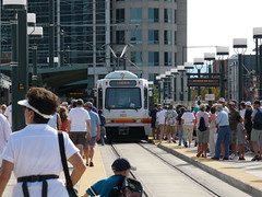
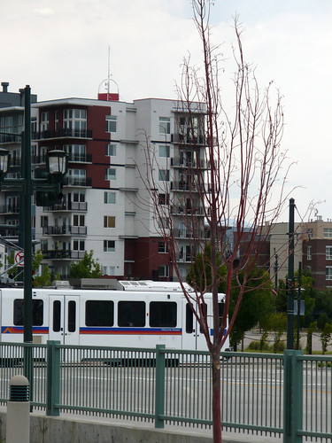
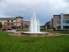
Wednesday, August 15, 2007
What is a Transit Region???
What exactly is a Transit Region? It is something that the conference will attempt to better understand, It is a short hand term to describe a place where transit has a major role in the vision of the future. Such places understand the connection between transit and land use and actively seek to create projects where transit plays a major role in implementing mixed use, walkable communities. Transit regions are places with real transportation choices - where there are abundant opportunities for bicycle and pedestrian travel as well travel by transit. There are places where it is possible to live most of your life without a car for your daily travel. Auto usage is still very important, but it is not the only choice. Finally it is a place where there is a general consensus that this is the way of the future.
In a transit region, goals are broader (efficiency, choice, sustainability, etc.) , tools are more interactive (public participation, workshops, etc) and solutions are get into how land use system should evolve and how the transportation system can be used to work towards the goals.
The goal of the conference is to better understand how transit regions evolve. Here are some questions to ponder
- What set of factors and circumstances are behind the transformation of a region to become a transit region?
- How important was the role of a champion? How do such people emerge?
- What is the relative role of elected officials, the private sector, regional planning agencies and transit agencies?
- Where does the leadership for such areas come from?
- Is it critical that there be a rail transit system?
- How can a bus system be used to affect land use?
- How important is the funding mechanism in the area?
- What local conditions – level of congestion, growth rate, city-suburb relationships, tax structure, etc. are conducive to being a transit region?
- How does the planning process take place?
- How do transit agencies get involved, (at the table) in regional planning and land use?
- How does the area resolve conflicts and reach consensus?
- What tools, models, etc. are needed to improve the planning and implementation process?
Monday, August 13, 2007
An Introduction - Our purpose
We are new to this blog thing so bear with us.
The purpose is to have a place to report on the TRB conference "Best Practices: Coordination of Transit, Land Use and Regional Planning. The conference is (was) held in Denver Aug 26-28, 2007. The purpose of the conference is to highlight the best of what is happening around the country for coordination of Transit, Land Use and Regional Planning. We picked Denver as a location because we felt that it was a place where everything seems to be working together to create a future where transit plays a strong role in land use and planning decisions.
Details on the conference are at: http://guest.cvent.com/EVENTS/Info/Summary.aspx?e=d2acf3d7-1d06-4e6f-8c18-955cc3c0cd97
Here is how we describe the conference purpose
In recent years, there have been many efforts to increase transit’s role in an integrated transportation and land use system, including: smart growth, regional transportation visioning, sustainable transportation, new urbanism, transit-oriented development, healthy community planning, etc. These efforts are all part of creating “Transit Regions” –areas where transit is a key element of the future. Although there are some successful examples, the promise of these activities is often unfulfilled. It is clear that much still needs to be done to promote more active participation by transit systems in regional transportation planning and land use decision making. TRB is sponsoring a specialty conference that would bring together experts to share experiences that lead to successful efforts to involve transit in the metropolitan planning process and land use decisions. The conference will include presentations of best practices as well as opportunities to discuss ideas with others in workshops. Key topics are Successful Transit Involvement in Regional Planning Processes and Successful Transit and Land-Use Initiatives The conference will also feature presentations and tours of Denver area land use and transit projects.
Subscribe to:
Comments (Atom)